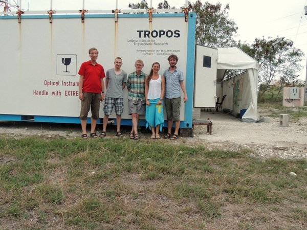
Dietrich Althausen, Michael Jähn, Albert Ansmann, Rodanthi-Elisavet Mamouri, Moritz Haarig (v.l.n.r.). Foto: Michael Jähn/TROPOS
Celebrating 50 Years of Sahara Dust Research on Barbados
(16th October 2015)
Half a century ago the dust on Barbados was first identified as Sahara dust. For the small island at the eastern edge of the Caribbean a historic moment. This discovery captured the attention of the international atmospheric research and is still relevant today. Therefore, the science continues to investigate the challenges posed by the Sahara dust on human health, the environment and the climate itself. A number of research institutes are dedicated to these questions now.
In mid-October the Caribbean Institute for Meteorology and Hydrology (CIMH) celebrated at Barbados this anniversary with a colloquium. Dr. Albert Ansmann, who researches for many years to dust in the atmosphere and has recently coordinated the remote sensing in the project SALTRACE, represented TROPOS here.
Links: Press release of CIMH: http://www.cimh.edu.bb/pdf/Release_Ragged%20Point%20Symposium_Oct12_Final.pdf
videos oft he colloqium „Celebrating 50 Years of Sahara Dust Research on Barbados“: https://www.youtube.com/watch?v=LxjWCQLX-m8
Caribbean Institute for Meteorology and Hydrology (CIMH): http://www.cimh.edu.bb/
Measurement campaign SALTRACE 2013: http://www.pa.op.dlr.de/saltrace/index.html
SALTRACE-3, Barbados, 19 June – 17 July 2014
With the 3rd SALTRACE (Saharan Aerosol Long-range Transport and Aerosol-Cloud-Interaction Experiment) campaign, TROPOS is collecting additional data to characterize mineral dust, which arrives the Caribbean via long-range transport from the Sahara. Primary focus of investigation is the change of the mineral dust size distribution during the 5000 km long way of transport. This has an impact on the radiative budget. Associated with SALTRACE-3 are the completed project SAMUM (Saharan Mineral Dust Experiment), the first summer campaign SALTRACE-1 and SALTRACE-2 in February 2014.
“During the winter campaign SALTRACE-2 we observed pure marine aerosol layers but also some Saharan dust layers (including traces of biomass burning particles), whereas we always had ‘dust days’ during summer 2013. The current SALTRACE-3 campaign gives us the opportunity to collect a greater number of case studies. With that, a better statistical analysis is possible”, explains Dr. Albert Ansmann, speaker of the SALTRACE consortium.
Dietrich Althausen, Michael Jähn, Albert Ansmann, Rodanthi-Elisavet Mamouri, Moritz Haarig (v.l.n.r.). Foto: Michael Jähn/TROPOS
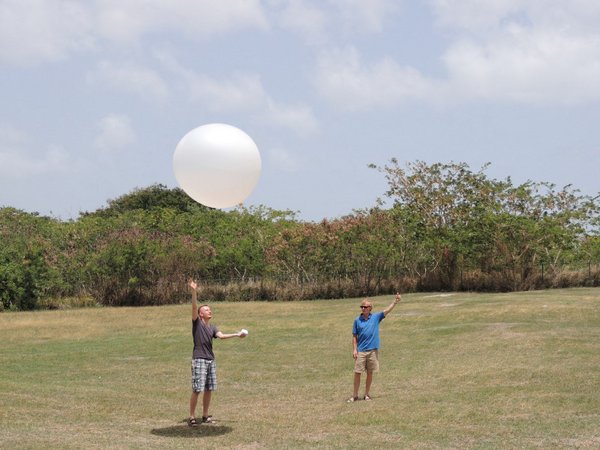
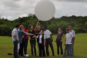
SALTRACE-3 already takes place for two and a half weeks. After a one day delayed arrival and some mandatory preparations, the first measurement was performed at 19 June with the BERTHA lidar from TROPOS. Multiple radiosonde releases during the day give information about vertical profiles of temperature, humidity and wind conditions. On 20 June, Rodanthi-Elisavet Mamouri from the Cyprus University of Technology (CUT) joined the TROPOS team (Albert Ansmann, Dietrich Althausen, Moritz Haarig). Mamouri studies the variability of aerosols and air pollution in the eastern Mediterranean with the aid of lidar measurement technique.
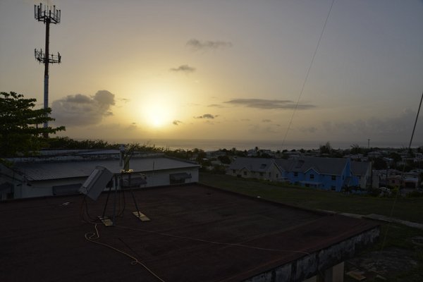
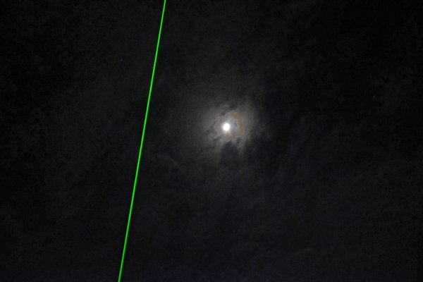
The “white sun” indicates present dust layers in the troposphere. Foreground: sun photometer. Photo: Michael Jähn/TROPOS
After a temporal laser breakdown the scientists kept calm. Dietrich Althausen was able to detect the cause of this error within a few days. With a provisional solution, further measurements were ensured. Moreover, almost no lidar measurements could have been performed during the time of breakdown due to a rain period. In the following days, dust layers were continuously determined again.
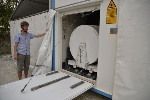
Moritz Haarig prepares a lidar measurement. Foto: Michael Jähn/TROPOS
On 3 July, Michael Jähn joined the SALTRACE crew. In the framework of his PhD thesis, Jähn investigates island effects in the trades exemplified by Barbados. For this, he performs large eddy simulations (LES) and uses the collected data to drive the model and for comparative studies.
Michael Jähn and Albert Ansmann releasing a radiosonde. Photo: Michael Jähn/TROPOS
The longest lidar measurement took place in the night of 5/6 July. The reason for this was the overflight of the CALIPSO environmental satellite, which gained data for the region near Barbados around 1 a.m. For the following days until 12 July, “normal” measurement operation is aspired, with one morning and evening session, respectively. As from 13 July, the containers, the whole measurement equipment and the tent will be dismounted. After that, the devices will go back to the 7600 km distant TROPOS.
Saharastaub-Messkampagne SALTRACE 2014 auf Barbados. Foto: Michael Jähn/TROPOS
SALTRACE 2013
SALTRACE setzt die erfolgreiche Grundlagenforsschung fort, die von 2004 bis 2011 unter dem Projekt SAMUN (Saharan Mineral Dust Experiment) von der Deutschen Forschungsgemeinschaft (DFG) gefördert und vom TROPOS koordiniert worden ist. Im Gegensatz zu den früheren Feldkampagnen liegt der Schwerpunkt jetzt auf dem gealterten Staub, um herauszufinden, wie sich die Strahlungs- und Klimaeigenschaften des Staubes auf dem Weg durch die Atmosphäre verändern.Im Gegensatz zu den Fortschritten, die in den letzten Jahrzehnten in der Klimaforschung gemacht worden, sind viele Fragen zu den Auswirkungen des Mineralstaubes immer noch offen. Im Sommer 2013 fanden daher umfangreiche Messungen auf und über Barbados statt. Die Insel am Rand der Karibik wurde für die Untersuchungen ausgewählt, da sie am Ende des atlantisches „Staubkorridores“ liegt und bereits Erfahrungen aus anderen Messkampagnen dort bestehen. Charakteristisch für Barbados sind die gleichmäßigen Passatwinde aus Richtung Afrika. Weil die Insel die östlichste der Karibischen Inseln ist und die Luft vom Atlantik kommt, gibt es hier – abgesehen von Schiffen und Flugzeugen – über Tausende von Kilometern praktisch keine von Menschen verursachte Luftverunreinigungen und damit auch keine anthropogenen Aerosolpartikel, die die Messungen verfälschen könnten.

Die Initiative SALTRACE kombinierte nun Boden- und Flugzeugmessungen mit Langzeitbeobachtungen, Modellierungen und Satellitendaten. „Wir wollen so unter anderen herausfinden, wie sich die Eigenschaften des Staubes auf dem Weg über den Atlantik verändern und welche Auswirkungen dies auf den Strahlungshaushalt der Atmosphäre und die Wolkenbildung hat“, fasst Dr. Albert Ansmann vom TROPOS zusammen, der die Idee zu SALTRACE hatte. Für uns als Forscher war der Tropensturm Chantal, der am 9. Juli haarscharf nördlich an Barbados vorbeizog, das Sahnehäubchen auf unseren Messungen. Wir haben dessen Auswirkungen auf den Wuestenstaub haarklein vermessen und so gut wie überhaupt keinen Staub in etwa 200 km Umfeld um den aktiven Kern gefunden", so Albert Ansmann, der sich von der Auswertung der Daten neue Erkenntnisse über die Entstehung von Hurrikans erhofft. "Es ist denkbar, dass Wüstenstaub die Wolkenbildung nur am Anfang beeinflusst. Wenn aber ein solcher Wirbelsturm erst einmal so richtig auf Touren gekommen ist, befreit es sich vom Staub, in dem er diesen auswäscht. Danach, also in der Phase vom Sturm zum Hurricane, spielt der Staub wohl keine Rolle mehr. Das Zentrum lebt dann nur noch von der Energie des warmen Wassers und dem marinen Aerosol. Das aktive Zentrum lässt keinen Staub mehr an sich ran", fasst Ansmann die neue Theorie zusammen.
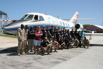
In der Luft
Falke auf der Staub-Jagd