-
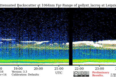
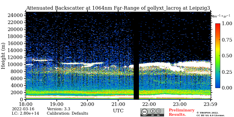
Saharan dust over Leipzig at an altitude of 7-11 km in the lidar measurements of TROPOS on the evening of 16.3.22. Source: TROPOS
-
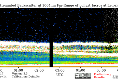
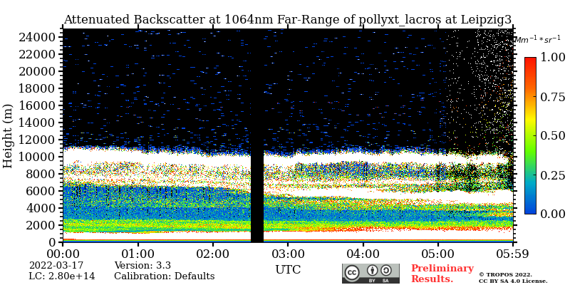
Sahara dust over Leipzig at an altitude of 7-11 km in the lidar measurements of TROPOS in the morning of 17.3.22. Source: TROPOS
-
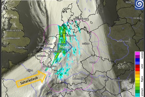
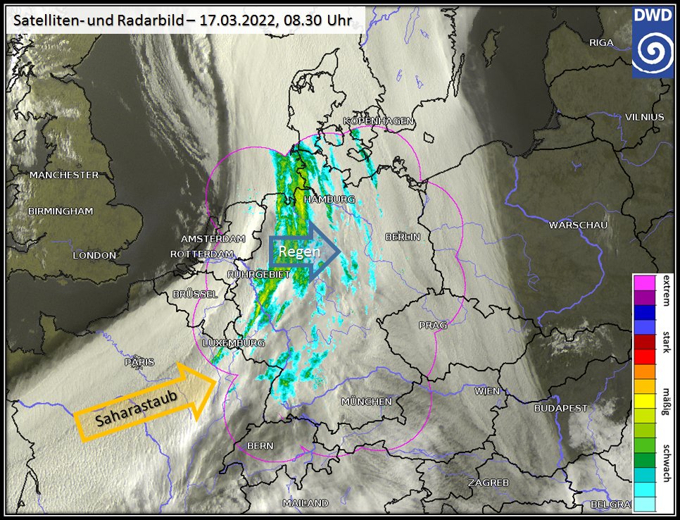
Satellite and radar image of 17.03.2022, 08:30 Source: DWD / https://twitter.com/DWD_presse/status/1504369315209953280/photo/1
-
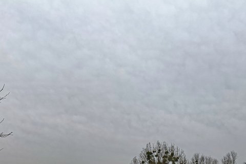
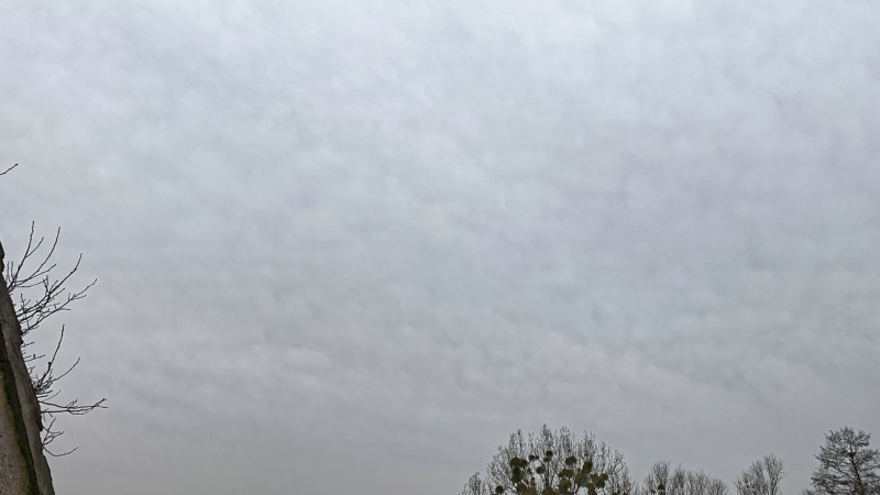
Thick cloud cover over Saxony on 17.3.22. Photo: Tilo Arnhold, TROPOS
Sahara dust causes extremely large cloud cover over Europe
Leipzig, 17 March 2022. Since Wednesday night, a strong layer of Sahara dust has been drifting over Leipzig at an altitude of 7-11 km (see TROPOS-PollyNet lidar measurements). These dust particles are perfect ice cores at -50C. The satellite images show an extreme amount of clouds over Spain, France and Germany. This is a huge cold cirrus blanket and most of the ice forms on dusty INPs.
How can the dust get to these high altitudes?
This is described in a paper that emerged in 2019 from measurements within CyCARE and BACCHUS in Cyprus:
Ansmann, A., et al, Ice-nucleating particle versus ice crystal number concentration in altocumulus and cirrus layers embedded in Saharan dust: a closure study, Atmos. Chem. Phys., 19, 15087-15115, https://doi.org/10.5194/acp-19-15087-2019 , 2019.
The abstract of this paper already says: "As a highlight, a long-lasting cirrus event associated with the development of a very strong dust-interspersed baroclinic storm (DIBS) over Algeria was studied."
"The DIBS was associated with strong convective cloud development and carried large amounts of Saharan dust into the upper troposphere, where the dust influenced the development of an unusually large anvil cirrus shield and subsequent transformation into a cirrus-uncinus cloud system. It is fascinating to now be able to study this phenomenon live over Leipzig," writes Dr Albert Ansmann, head of the Ground-based Remote Sensing working group at TROPOS.
Links:
Cyprus Clouds Aerosols and Rain Experiment (CyCARE)
https://www.tropos.de/institut/abteilungen/fernerkundung-atmosphaerischer-prozesse-neu/ag-bodengebundene-fernerkundung/cyprus-clouds-aerosols-and-rain-experiment-cycare
BACCHUS
https://www.tropos.de/forschung/grossprojekte-infrastruktur-technologie/verbundprojekte/bacchus