EarthCARE stares into the eye of Tropical Cyclone Vince
Leipzig, 16.06.2025 – Sebastian Bley
First synergetic data set from space for a tropical cyclone like Vince
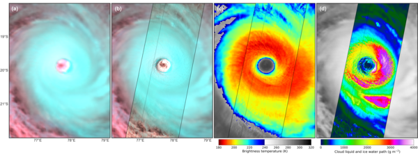
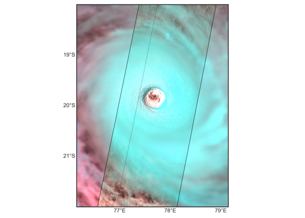
A rare glimpse into the eye of Tropical Cyclone Vince, thanks to EarthCARE’s multispectral imager, gave us a crisp picture of the fine-scale structures in and around the eye wall and recorded some remarkable features of the storm.
Vince formed on 1 February 2025 in the South-West Indian Ocean. At its peak intensity Vince hit maximum wind speeds of 248 km/h and a minimum central pressure of 923 hPa.
On the very same day, 7 February, that Vince was classified as a Category 4 Very Intense Tropical Cyclone, ESA’s Earth Cloud Aerosol and Radiation Explorer (EarthCARE) satellite flew right over it, capturing the eye of the storm in high resolution.
This is a rare opportunity. There are only 20-25 intense tropical cyclones each year, and due to the narrow swath measured by EarthCARE, and its orbital alignment, you would expect such an occurrence less than once a year.
The EarthCARE Data, Innovation and Science Cluster (DISC) has grasped the opportunity, gaining invaluable insights into the structure and microphysical properties of the cumulonimbus cloud associated with the storm.
…
Learn more via ESA here: https://earth.esa.int/eogateway/success-story/earthcare-stares-into-the-eye-of-tropical-cyclone-vince


