New Zealand: Record-breaking storm observed by remote-sensing platform LACROS
Waihōpai/Invercargill, 21.11.2025 – Tom Gaudek, Patric Seifert
records at Invercargill for the last 28 years
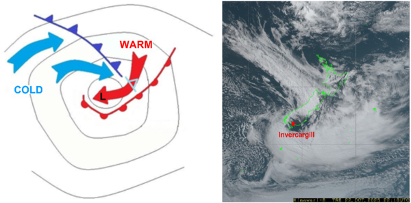
Severe winds caused devastation and widespread power outages in New Zealand on 23 October 2025. Torn-off roofs and fallen trees dominated the news in the following days. Fortunately, there was no significant damage at our remote-sensing platform LACROS and the brief interruption of power and internet was also overcome. To the involved meteorologists in GoSouth-2, this rare event represents the next measurement highlight, as LACROS was able to observe the cyclone throughout its entire passage over the station. The atmospheric system is known among experts as a Shapiro-Keyser cyclone – a special form of the classical cyclone described by the Norwegian model, which frequently occurs over Germany, for example.
The Shapiro-Keyser cyclone model
The Shapiro-Keyser cyclone differs from the Norwegian cyclone type by means of a much more rapid deepening of its surface low during the intensification stage. This behavior results from a different vertical structure compared to the Norwegian cyclone. A distinctive feature of a Shapiro-Keyser cyclone is the sting jet, which can produce extremely high wind speeds near the cyclone center. At the time of its passage over LACROS, the system appeared to have nearly reached its mature stage. More detailled information about the Shapiro-Keyser cyclone life cycle can be found here.
Measurements
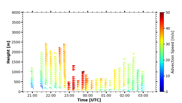
During the passage of the front at around 23 UTC, wind gusts with 137 km/h (74 kn) and 10-minutes average surface winds of 102 km/h (55 kn) were recorded at Invercargill airport close to the MetService site. Those numbers are marking records at Invercargill for the last 28 years. A wind profile measured by the LACROS Doppler lidar SKIPPER indicates the rapid velocity changes across the lower few kilometers above the site. Average wind speeds of up to 80 kn in the lowest height bin are only rarely observed.
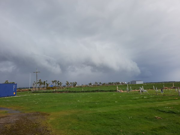
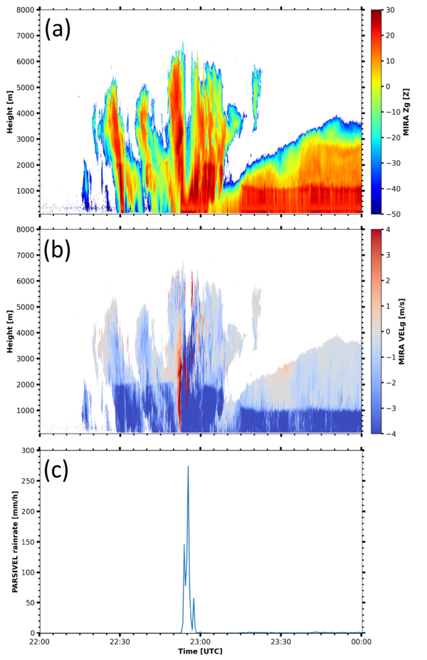
Also, the observations from one of the LACROS cloud radars (Mira-35) showed impressive observational features. The arrival of the front at 22:52 UTC is marked by high radar reflectivities of up to 30 dBZ at around 3 km height (with attenuation effects at greater heights) and highly turbulent conditions with strong updraft velocities as indicated in the Mira-35 vertical-velocity display. The front was accompanied with a bow-shaped cloud field which is a signature for a very strong free-tropospheric dry-air intrusion. The front passage was also related to a 1000-meter drop of the 0°C level, as can be seen by the shift of the high-velocity rain band from heights of 2000 m down to heights of 1000 m shortly past 23:00 UTC. Last but not least, extreme rainfall rates higher than 250 mm per hour were recorded by the Parsivel² disdrometer, albeit that parts of this extremely high value was caused by flying debris which passed the probing volume of the disdrometer. Nevertheless, the official MetService 1-minute rainfall rate measurement at Invercargill Airport still indicated around 100 mm/h.
Reference and further information:
https://resources.eumetrain.org/satmanu/CMs/SKCycl/print.htm


