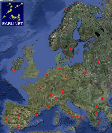
Map with the location of the 27 EARLINET stations.

Overview
EARLINET (European Aerosol Research Lidar Network) is the first aerosol lidar network which attempts to retrieve quantitative data on the vertical distribution of aerosol optical properties in a systematic and statistically significant approach and on a continental scale. Therefore, the main effort as well as the main achievements are in the development of methods. Strong emphasis is on making the results from all stations and all times comparable, because this is essential for the use of joint data sets in all studies involving several stations.
EARLINET was started in 2000 as a infrastructure project funded by the European Comission. Since 2011 it is part of ACTRIS.
TROPOS is an essential member of EARLINET. It was already involved into the foundation of EARLINET in 2000. Amongst others, TROPOS contributes to the support and development of EARLINET via the following activities:

Map with the location of the 27 EARLINET stations.
Goals
The main objectives of EARLINET are the establishment of a comprehensive and quantitative statistical data base of the horizontal and vertical distribution of aerosols on the European scale using a network of advanced laser remote sensing stations, and the use of these data for studies related to the impact of aerosols on a variety of environmental problems. This also includes the creation of a suitable research infrastructure comprising quality controlled instruments and evaluation procedures as well as the establishment of a common data base. Also important is a system of internal communication for exchange of technical know-how and data as well as for the performance of joint analyses using data from several groups. The intensive observational period lasted from May 2000 to February 2003. Measurements are continued on a volunteering basis by several groups since then.
Achievements